
Ecuador is located in northwestern region of South America. Ecuador 73rd largest country in the world with land size of 283,561 km2. That is almost the size of Italy. The equator crosses through the country and that is where it’s name was derived from. Water areas and well-known lakes make up about 5% of the surface of the whole country. Ecuador borders only with two countries. In the north with Colombia and in the south with Peru. Ecuador lost about two-thirds of its original size in 1830 during many territorial disputes with both neighbors.
In the west, the landscape is occupied by the Pacific Ocean with a length of 2,237 km and thus offers huge opportunities for tropical beaches. The border with Peru is 1,529 km long and the one with Colombia only 708 km. Further northwest can be found the Galapagos Islands and all with its fascinating fauna and flora are part of Ecuador. The country is divided into 4 regions, 7 regions and 24 provinces. The areas are divided according to geographical division into a coastal area known as “La Costa”, the Andes mountain area “La Sierra”, the Amazon called “El Oriente” and the Galapagos.
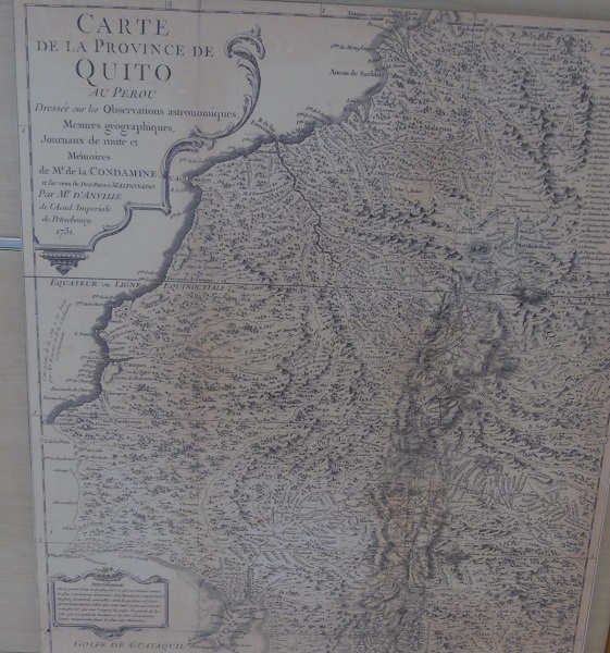
And this is what the historical map of Ecuador looks like:
Read more
7 Reasons You Need to Visit Ecuador
9 Reasons Why You Should Visit Salinas in Ecuador